


Search results for 'island'
-

3109 Bowen, Emanuel: A Complete Map of the Southern Continent. Survey´d by Capt. Abel Tasman & depicted by Order of the East India Company in Holland... 1744
Oceania / South Pazific | Australia
Ozeanien / Australien
Bowen, Emanuel
1744€4,190.00Incl. 7% tax, Excl. shipping -
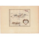
![20035 Norie & Wilson: The Caribean Islands, &c., 1878 [Blueback sea chart]](https://www.oldmapcenter.com/media/catalog/product/cache/4/small_image/135x135/9df78eab33525d08d6e5fb8d27136e95/c/a/caribbeevirgin03_2.jpg)
20035 Norie & Wilson: The Caribean Islands, &c., 1878 [Blueback sea chart]
Norie & Wilson
The Caribean Islands, &c., 1878
€950.00Incl. 7% tax, Excl. shipping -
![20024 James Imray & Son: The Coast of Cape Colony, 1881 [Blueback sea chart]](https://www.oldmapcenter.com/media/catalog/product/cache/4/small_image/135x135/9df78eab33525d08d6e5fb8d27136e95/c/a/capecolony02_1.jpg)
20024 James Imray & Son: The Coast of Cape Colony, 1881 [Blueback sea chart]
James Imray & Son
The Coast of Cape Colony, 1881
€850.00Incl. 7% tax, Excl. shipping
-

3800 Merian, Mattheus: China Veteribus Sinarum regio nunc Incolis Tame dicta 1660
Asia / East Asia | China
Asien / China
Merian, Mattheus
c. 1660€1,400.00Incl. 7% tax, Excl. shipping -
3805 Jacques Nicolas Bellin: Carte des Isles des Vierges 1764
Karibik / Virgin Islands
Jacques Nicolas Bellin
1764€1,100.00Incl. 7% tax, Excl. shipping -

3811 Popple, Henry: Amerique Septentrionale 1742
America / North America | East Coast
Amerika /
Popple, Henry
dat. 1742€2,950.00Incl. 7% tax, Excl. shipping
-

3822 Cesar, Jules Sebastian: Plan de l Ile Tonga-Tabou Leve et dresse par M.E. Paris, Enseigne de Valisseau. Expedition de la Corvette de S.M. l Astrolabe 1827
Oceania / Friendly Islands
Ozeanien / Friendly Islands
Cesar, Jules Sebastian
1827€710.00Incl. 7% tax, Excl. shipping -

2360 Moll, Hermann / Capt. Greenville CollinsThe Islands of Orkney 1693
Western Europe / lslands of Orkney
Westeuropa / Islands of Orkney
Moll / Capt. Greenville Collins
about 1693€890.00Incl. 7% tax, Excl. shipping -

2393 Zatta, Antonio: L´Acadia, le Provincie di Sagadahook e Main, la Nuova Hampshire, la Rhode Island, e Parte di Massachusset e Connecticut. 1785
America / Canada
Amerika / Kanada
Zatta, Antonio
about 1785€1,980.00Incl. 7% tax, Excl. shipping
Search by map

Global Search
Detailed Search
Shopping Options
- Title(keyword)
- Cartographer
A
B
C
D
E
F
H
I
J
K
L
M
N
O
P
R
S
T
V
W
Z
- Region
- Time
- Price
Our Partners
The World Record Holder for the Most Certified Island Sales!
Learn more>>
 Order online from Germany's Leader in travel maps, travel guides and much more!
Visit Dr. Götze>>