


Map Shop
7 Item(s)
Grid List
-
![20010 James Imray & Son: Cape Verde Isles, 1877 [Blueback sea chart]](https://www.oldmapcenter.com/media/catalog/product/cache/4/small_image/135x135/9df78eab33525d08d6e5fb8d27136e95/c/a/capeverdeislands03_1.jpg)
20010 James Imray & Son: Cape Verde Isles, 1877 [Blueback sea chart]
James Imray & Son
Cape Verde Isles
€400.00Incl. 7% tax, Excl. shipping -
![20035 Norie & Wilson: The Caribean Islands, &c., 1878 [Blueback sea chart]](https://www.oldmapcenter.com/media/catalog/product/cache/4/small_image/135x135/9df78eab33525d08d6e5fb8d27136e95/c/a/caribbeevirgin03_2.jpg)
20035 Norie & Wilson: The Caribean Islands, &c., 1878 [Blueback sea chart]
Norie & Wilson
The Caribean Islands, &c., 1878
€950.00Incl. 7% tax, Excl. shipping -
![20031 Norie & Wilson: St. Georges Channel etc., 1870 [Blueback sea chart]](https://www.oldmapcenter.com/media/catalog/product/cache/4/small_image/135x135/9df78eab33525d08d6e5fb8d27136e95/s/t/stgeorgeschanel02_1.jpg)
20031 Norie & Wilson: St. Georges Channel etc., 1870 [Blueback sea chart]
Norie & Wilson
St. Georges Channel etc., 1870
€750.00Incl. 7% tax, Excl. shipping
-
![20009 James Imray & Son: Coast of South America included between Cayenne and Maranhao, 1882 [Blueback sea chart]](https://www.oldmapcenter.com/media/catalog/product/cache/4/small_image/135x135/9df78eab33525d08d6e5fb8d27136e95/images/catalog/product/placeholder/small_image.jpg)
20009 James Imray & Son: Coast of South America included between Cayenne and Maranhao, 1882 [Blueback sea chart]
James Imray & Son
Coast of South America included between Cayenne and Maranhao, 1882
€850.00Incl. 7% tax, Excl. shipping -
![20024 James Imray & Son: The Coast of Cape Colony, 1881 [Blueback sea chart]](https://www.oldmapcenter.com/media/catalog/product/cache/4/small_image/135x135/9df78eab33525d08d6e5fb8d27136e95/c/a/capecolony02_1.jpg)
20024 James Imray & Son: The Coast of Cape Colony, 1881 [Blueback sea chart]
James Imray & Son
The Coast of Cape Colony, 1881
€850.00Incl. 7% tax, Excl. shipping -
![20032 Norie & Wilson: The Western Part of the Mediterranean Sea. From Gibraltar to Malta, 1879 [Blueback sea chart]](https://www.oldmapcenter.com/media/catalog/product/cache/4/small_image/135x135/9df78eab33525d08d6e5fb8d27136e95/m/e/mediterranwest06_1.jpg)
20032 Norie & Wilson: The Western Part of the Mediterranean Sea. From Gibraltar to Malta, 1879 [Blueback sea chart]
Norie & Wilson
The Western Part of the Mediterranean Sea. From Gibraltar to Malta, 1879
Cartographer: J. W. Appleton
€1,650.00Incl. 7% tax, Excl. shipping
-
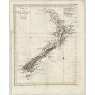
2588 Bayly, John Abraham: Kaart van Nieuw Zeeland in de Jaaren 1769 en 1770 bezogt door den Luitenant J.Cook. 1772
Oceania / New Zealand
Ozeanien / Neuseeland
Bayly, John Abraham (Engraver)
ca. 1772€2,980.00Incl. 7% tax, Excl. shipping
7 Item(s)
Grid List

Currently Shopping by
-
Cartographer: Bayly, John Abraham
 , Imray, James , Norie & Wilson
Shopping Options
- Title(keyword)
- Cartographer
A
B
C
D
E
F
H
I
J
K
L
M
N
O
P
R
S
T
V
W
Z
- Region
- Time
- Price
The World Record Holder for the Most Certified Island Sales!
Learn more>>
 Order online from Germany's Leader in travel maps, travel guides and much more!
Visit Dr. Götze>>