


Map Shop
6 Item(s)
Grid List
-
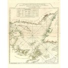
![20035 Norie & Wilson: The Caribean Islands, &c., 1878 [Blueback sea chart]](https://www.oldmapcenter.com/media/catalog/product/cache/4/small_image/135x135/9df78eab33525d08d6e5fb8d27136e95/c/a/caribbeevirgin03_2.jpg)
20035 Norie & Wilson: The Caribean Islands, &c., 1878 [Blueback sea chart]
Norie & Wilson
The Caribean Islands, &c., 1878
€950.00Incl. 7% tax, Excl. shipping -
![20031 Norie & Wilson: St. Georges Channel etc., 1870 [Blueback sea chart]](https://www.oldmapcenter.com/media/catalog/product/cache/4/small_image/135x135/9df78eab33525d08d6e5fb8d27136e95/s/t/stgeorgeschanel02_1.jpg)
20031 Norie & Wilson: St. Georges Channel etc., 1870 [Blueback sea chart]
Norie & Wilson
St. Georges Channel etc., 1870
€750.00Incl. 7% tax, Excl. shipping -
![20032 Norie & Wilson: The Western Part of the Mediterranean Sea. From Gibraltar to Malta, 1879 [Blueback sea chart]](https://www.oldmapcenter.com/media/catalog/product/cache/4/small_image/135x135/9df78eab33525d08d6e5fb8d27136e95/m/e/mediterranwest06_1.jpg)
20032 Norie & Wilson: The Western Part of the Mediterranean Sea. From Gibraltar to Malta, 1879 [Blueback sea chart]
Norie & Wilson
The Western Part of the Mediterranean Sea. From Gibraltar to Malta, 1879
Cartographer: J. W. Appleton
€1,650.00Incl. 7% tax, Excl. shipping
-

2891 Jefferys, Thomas (bei W. Faden): A Map of the Ling of Great Briains Dominions in Germany, or the Electorate of Brunswick-Luneburg, with ist Depemdencies; .... 1781
Western Europe / Germany / Lower Saxony / Brunswick - Lüneburg
Westeuropa / Deutschland / Niedersachsen / Braunschweig - Lüneburg
Jefferys, Thomas bei W. Faden
dat. 1781€385.00Incl. 7% tax, Excl. shipping -
2496 Sayer, Robert & Bennet, John: A Chart of the Gulf of St.Laurence, Composed from a Great Number of Actual Surveys and Other Materials 1775
America / Canada
Amerika / Kanada
Sayer, Robert & Bennet, John
1775€870.00Incl. 7% tax, Excl. shipping -

3288 Santini,P. / Remondini,M.: Partie Orientale du Canada, avec la Nouvelle Angleterre, l´ Acadie, et la Terre-Neuve, par le S. D´Anville 1776
America / Canada
Amerika / Kanada
Santini,P. / Remondini,M.
1776€1,990.00Incl. 7% tax, Excl. shipping
6 Item(s)
Grid List

Currently Shopping by
-
Cartographer: Jefferys, Thomas
 , Norie & Wilson , Santini, Paolo , Sayer, Robert
Shopping Options
- Title(keyword)
- Cartographer
A
B
C
D
E
F
H
I
J
K
L
M
N
O
P
R
S
T
V
W
Z
- Region
- Time
- Price
The World Record Holder for the Most Certified Island Sales!
Learn more>>
 Order online from Germany's Leader in travel maps, travel guides and much more!
Visit Dr. Götze>>