Map Shop
-

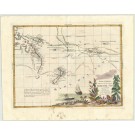
2569 Zatta, Antonio: Nuove Scoperte fatte nel 1765.67 e 69 nel Mare del Sud. 1776
€1,450.00Incl. 7% tax, Excl. shipping -

-
![20035 Norie & Wilson: The Caribean Islands, &c., 1878 [Blueback sea chart]](https://www.oldmapcenter.com/media/catalog/product/cache/4/small_image/135x135/9df78eab33525d08d6e5fb8d27136e95/c/a/caribbeevirgin03_2.jpg)
20035 Norie & Wilson: The Caribean Islands, &c., 1878 [Blueback sea chart]
€950.00Incl. 7% tax, Excl. shipping -
![20031 Norie & Wilson: St. Georges Channel etc., 1870 [Blueback sea chart]](https://www.oldmapcenter.com/media/catalog/product/cache/4/small_image/135x135/9df78eab33525d08d6e5fb8d27136e95/s/t/stgeorgeschanel02_1.jpg)
20031 Norie & Wilson: St. Georges Channel etc., 1870 [Blueback sea chart]
€750.00Incl. 7% tax, Excl. shipping -
![20032 Norie & Wilson: The Western Part of the Mediterranean Sea. From Gibraltar to Malta, 1879 [Blueback sea chart]](https://www.oldmapcenter.com/media/catalog/product/cache/4/small_image/135x135/9df78eab33525d08d6e5fb8d27136e95/m/e/mediterranwest06_1.jpg)
20032 Norie & Wilson: The Western Part of the Mediterranean Sea. From Gibraltar to Malta, 1879 [Blueback sea chart]
€1,650.00Incl. 7% tax, Excl. shippingNorie & Wilson
The Western Part of the Mediterranean Sea. From Gibraltar to Malta, 1879
Cartographer: J. W. Appleton
Learn More -

-

2480 Zatta, Antonio: Le Colonie Unite dell´America Settentr.le di Nuova Projezione 1778
€9,400.00Incl. 7% tax, Excl. shipping -

2514 Zatta, Antonio: Le Isole di Terra Nuova e Capo Breton Di Nuova Projezione 1778
€580.00Incl. 7% tax, Excl. shipping -

2633 Zatta, Antonio: La Baja D´Hudson, Terra di Labrador e Groenlandia con le Isole Adiacenti. 1778
€540.00Incl. 7% tax, Excl. shipping -


